1660: The Birth of New York City: Origin of New (Nieuw) Amsterdam on Manhattan Island
In 1624, the Dutch West India Company founded New Amsterdam on Manhattan Island, laying the groundwork for what would become the heart of New Netherland. A year later, the construction of Fort Amsterdam at the island’s southern tip marked a critical development, serving not only as a vital defensive structure but also controlling access to the Hudson River. This fortification played a crucial role in both defense and trade, helping to secure prosperity. The establishment of the Northern Palisade in 1653 further fortified the settlement against northern threats, and its location eventually evolved into Wall Street, the financial epicenter of today’s New York City. These early infrastructural decisions were instrumental in shaping the strategic layout and significance of New York City, highlighting its transformation from a Dutch outpost to a global urban powerhouse.
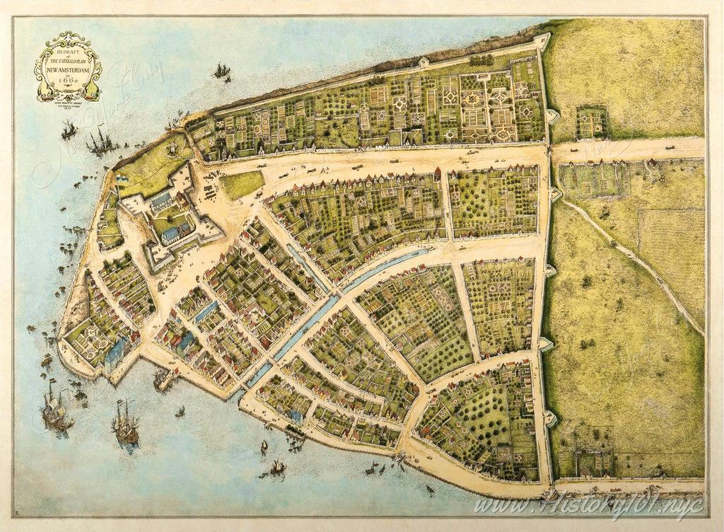
An illustrated map from the period vividly captures New Amsterdam’s expansion, showing the growing presence of Dutch settlers. It carefully delineates Fort Amsterdam’s strategic position as a southern port and the Northern Palisade’s role in safeguarding the colony. These elements not only reflect the city’s historical journey in commerce and defense but also its significant urban development. Through this map, one can trace the lineage of New York City’s bustling streets back to its origins as a fortified Dutch settlement, offering a unique perspective on its evolution.
This detailed representation of New Amsterdam illustrates the settlement’s complexity and its foundational role in New York City’s history. The strategic importance of locations like Fort Amsterdam and the area that would become Wall Street underscores the foresighted planning and adaptability of the early settlers. These landmarks not only served immediate practical purposes but also set the stage for the city’s future growth and status as a global financial hub.
In sum, the transformation of New Amsterdam into New York City is a testament to the enduring impact of its early colonial infrastructure on its development into a major urban center. The narrative of Fort Amsterdam and Wall Street from defense mechanisms to symbols of trade and economic prosperity reflects the dynamic evolution of the city. This rich history lays the foundation for understanding New York City’s prominence on the world stage, reinforcing its legacy as a city built on strategic ingenuity and cultural amalgamation.